

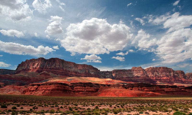

- Vermilion Cliffs offer beautiful scenery as you travel from Arizona to Utah
- Launch a raft at Lee’s Ferry to float down the Colorado River
- Hike to the Plateau from Highway 89A
- Camp out under the stars near Vermilion Cliffs
- Visit the Wave and its colorful rock formations
What can I see and do at the Vermilion Cliffs?
- Navajo Bridge: This bridge, the only road where you can get to the other side of the Grand Canyon for 600 miles, spans Marble Canyon, taking the driver to the northern rim of Grand Canyon and southern Utah.
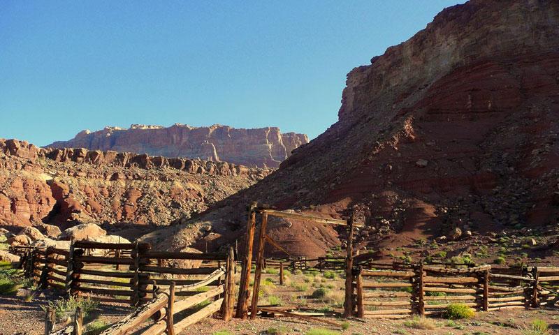
- Historic spot: Driving along Highway 89A, you will be following an old wagon route of early pioneers. Get the feel of the Old West from the 19th Century as you pass through House Rock Valley.
- Views: Stop at a number of overlooks as you drive US Highway 89. You can view Vermilion Cliffs from afar at the Antelope Pass Scenic Overlook, stop at the Navajo Scenic Overlook on the Navajo Reservation or experience a panorama of Kaibab Plateau and the Vermilion Cliffs from a highway pullout east of Johnson Canyon.
- Lee's Ferry: Launch a raft at Lee’s Ferry to travel down the Colorado River, or simply throw in a fishing line to catch a trophy trout. This was once the site of a ferry crossing the Colorado, and now offers a wide array of outdoor fun.
- Glen Canyon National Recreation Area: Here is where you’ll find Lake Powell and plenty of water sports to enjoy. Get out on the water with your jet skis, fish, go kayaking or rent a houseboat.
- Coyote Buttes: This section of Vermilion Cliffs is the perfect place to hike, although only 20 people per day are allowed in. Coyote Buttes is part of Vermilion Cliffs National Monument and spans north central Arizona and south central Utah.
- The Wave: Part of Coyote Buttes, the Wave is a sight not to miss, even with a three-mile hike across the desert. This sandstone rock formation contains undulating colorful formations making incredible photos to take home with you.
- Hiking: As you travel up Highway 89A, you will find a hiking trail taking you to the Plateau. You’ll find it between mileposts 557 and 558, close to the Escalante-Dominguez historic marker.
- Camping: Primitive camping is popular along the route along Vermilion Cliffs. A perfect ending to a perfect day, spending some time under the stars!
Where are the Vermilion Cliffs?
Vermillion Cliffs can be found along US Highway 89 and 89A near Navajo Bridge. They extend west from close to Page, Arizona into Utah.
When are the Vermilion Cliffs accessible?
Vermilion Cliffs is accessible the year round, except when roads may be closed due to snow. The best time to visit is from May to October.
How much does Vermilion Cliffs cost?
Vermillion Cliffs Arizona is free to visit and there are no admission fees.
Who can I call if I have more questions?
If you want more information about Vermilion Cliffs, you can call the BLM Arizona Strip Field Office at (435) 688-3200.